Claeys Road Diaries
“Of all the paths you take in life, make sure a few of them are dirt" ~John Muir
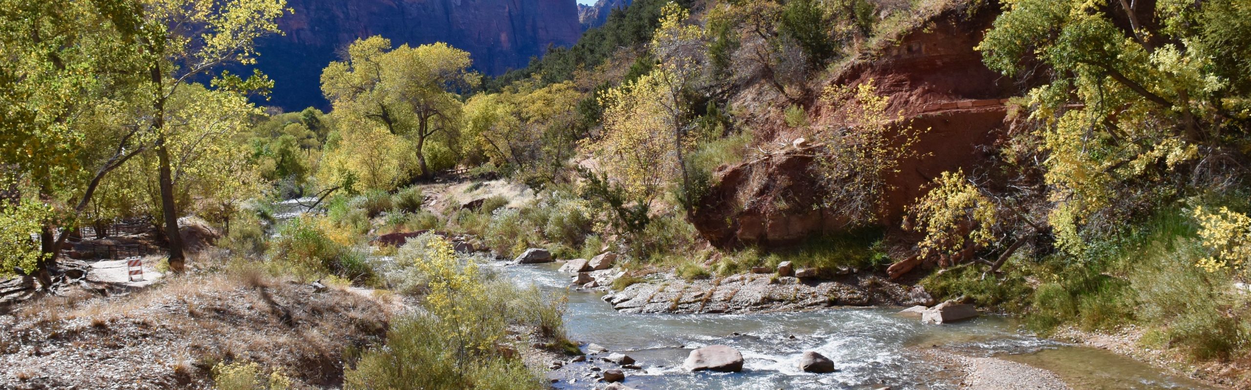


We’re heading out of Texas now towards Houston, with its sky scrapers made of shiny steel and sheets of glass, shimmering in the afternoon sun, full of promise and success, built on the abundance of fossil fuels in underground oceans beneath the Texas deserts. Texas is a big state and we have crossed it from north to south and now are going from west to east. We have hiked its deserts and mountains. We have driven for hours and days and now we are approaching its eastern edge. We’ve gone from barren, unpopulated deserts to rolling hills and big cities. I don’t want to leave the Lone Star State and there’s two reasons for that. One, is that it represents us leaving the western United States and going and getting west is part of the allure of going cross country like we have. The west is the rockies, and the Pacific and the deserts of the southwest. It represents the stark differences from the east coast and there is an excitement associated with being in this different world. As we head now towards Beaumont Texas, I know we will cross into Louisiana and we will be leaving the west behind. We will be heading east and our western swing portion of the journey will be over. I know we still have 5 months of travel left but I can’t help feeling an end to this significant part of our trip. The second reason is that I like Texas. The first time I came here was when I shipped out for basic training to San Antonio, Texas. Young, eyes wide open, long hair on the floor of the processing center, and learning the ways of the Air Force. After basic training I spent a year here in tech school and it was during that time that the transition occurred. I remember hating country music and expecting all of Texas to be red necks but the longer I was here, the more I found myself enjoying the “Texas Culture” and really embracing it. It’s cowboy hats, cowboy boots under jeans, and ornate, thick, leather belts with your name embossed on the back. It’s long sleeved shirts with pearl snaps for buttons. It’s horses, and rodeos, and Lone Star Beer, and pick up trucks and pick up trucks and pick up trucks! It’s deserts and its rolling hills, and big horizons and endless blue skies and long horn cattle. It’s a state where the Texas flag might be seen flying in more places than the American flag. It’s where you’ll see “Don’t Mess With Texas”, Dallas Cowboys, and “The Rest of You Can Go To Hell, I’m Going to Texas” by Davey Crockett, on bumper stickers and signs from one side of the state to the other. And its got country western music from more radio stations than you can begin to count playing modern country, classic country, and the Outlaw country music of Willie, Waylon, and Jerry Jeff. It’s coyotes howling at a desert moon in the land that was ruled and revered by Apaches and Commanches. It’s Tex/Mex food and football at the High School, College, and professional level that is a religion. There’s so much more but there’s one thing that’s hard to put a word on so I’ll just call it that ‘”Independent Spirit” and an identity that seems to be among the citizens here that almost makes you wish you were from Texas. And lastly, it was Guadalupe National Park and Big Bend National Park that took us through the deserts and mountains and rivers of West Texas and treated us to a mighty fine meal of Mother Nature. We actually are in Louisiana now and whether its real or imagined, we know that we’re no longer in the west and no longer in Texas and I can’t help feeling sad about that. As Roy Rogers and Dale Evans used to sing: “Happy Trails, To You, Until We Meet Again”, and if you don’t know the TV show that its from, ask your parents. Until then, find some time and take a trip to Texas and experience it yourself. You won’t be disappointed.


It is a land of huge expanses. Of dusty, arid deserts bordered by dry mountain ranges. Of tans and browns and greens and blues. Of skies that make you feel smaller than you ever have felt, in a land that takes you in. Whose vast vistas leave you frozen in awe. It is a liberating and spiritual place that takes away all your stress and lets each singular thought flow freely through your consciousness. It is a land of deserts and mountains and forests too. It is a land of riparian ecosystems that thrive along the beautiful Rio Grande River and parallel each of its banks with a lush, thick, green border. It is also a land of a vast diversity of life that is well adapted to the challenges that very little rainfall brings. It is a birdwatchers paradise and a place to watch the desert explode in color during the rainy season when cacti, bushes, tree’s, and plants put forth an amazing display of flowers and seeds to take advantage of the water for the success of their next generation. It is home to hundreds of species of birds, and cacti, and plants, and insects. It is a land where mountain lions, Mexican Black Bears, Javalena’s, Road Runners, and Coyotes roam. Javalenas look like blackish/grey pigs but are actually members of the Peccary family. We had been hoping to see them but it didn’t happen until we were leaving the park and we spotted one crossing the road and trying to get through the cattle fence on the other side. They are nocturnal animals so it was unusual to see them during the day. It is the land and home of the Apaches and the Comanche’s, long before we farmed it, mined it, or made it a National Park. It is Big Bend National Park and in the lower 48, it is the most remote of the National Parks, but one, which is worth every effort to get to it.
Some of the mountains are bare, save for the rock, sand, and sediment they were formed from millions of years ago. Other mountains are dotted with a dispersed pattern of cacti, bunches of grasses, small bushes, and small trees, giving them an impressionistic appearance from a distance. The earth tones of tans, browns, and greens under a broad blue sky has a subtle and calming effect on you. It is also a land of contrasts. We have hiked in ninety-degree sunshine only to shiver in the morning to a twenty-two degree sunrise! And if you’re willing to put on your hiking shoes, you can hit a trail that starts in a lush, riparian ecosystem at the Rio Grande, then up to a desert ecosystem that morphs into a grassland and eventually turns into a forest of deciduous and evergreens as you pass up through the Chisos Mountains. What a transition! The Chisos Mountains by the way are the only complete mountain system contained in a national park. You can’t help but appreciate the many different cacti and plants that live in the Chihuahuan Desert here. They are all magnificently adapted to the scarcity of water and are masters at absorbing it, protecting it from evaporating, and, protecting themselves from all other living things that would eat it for the water they contain.
We spent 5 days in the park, which is woefully inadequate to take in all that it has to offer. We used our time well though and were rewarded with so many memorable experiences. We did canyon hikes in both Santa Elena and Boquillos Canyons through which the Rio Grande passes. The Boquillos Canyon is where the Rio Grande takes a 90 degree turn which gives the park its name. It is a very short hike. Santa Elena was also relatively short at just under two miles but was also the more beautiful of the two with 1500 foot cliffs along the canyon trail as well as broad vistas of the river, canyon, and desert. We did mountain hikes in the Chisos Mountains that included a 6 mile hike on the Lost Mine Trail as well as a 10 mile hike to Emory Peak, the highest point in the park. It rewarded us with breath taking 360 degree vistas of the mountains and the desert below from the summit as well as the hike up and back. We regret not having the time to do the South Rim Trail based on reports from other hikers but its on our bucket list. It was a busy weekend in the park and the Chisos Basin Campground in which we were staying was full. As we relaxed one afternoon after a hike, we watched a pickup truck full of five college students look frustratingly for a site, of which there were none. We’ve done it before so we offered them to put up their tents in our site as we had the space and could accommodate them. They jumped at the offer. They were really a great bunch of “kids” and appreciated our hospitality. They cranked out hikes as fast as they could to take advantage of their weekend in the park. They were smart, engaging, humorous, and really added to our enjoyment at this stop in the park. After leaving the Chisos, we moved to the Rio Grande Campground and did a true desert hike of 6 miles from Edwards Ranch to the Hot Springs and back. It was hot and sunny and though a relatively easy trail, there was very little traffic on it. It provided beautiful view points of the Rio Grande which flowed below the many cliffs the trail took us along as well as views of the desert leading up to the distant mountains. We drove to the Hot Springs the day before and it was extremely crowded as it was the Martin Luther King Day long weekend. The crowds were a turn off so we decided to not come back to soak in it. When we hiked out there on the other hand, it was hardly crowded at all and I wished we had brought our bathing suits for a mid hike soak. Oh well.
The Chisos Mountains represent volcanoes that formed and erupted, creating that mountain geology portion of the middle of the park while the land to the west was covered with an inland sea before it evaporated. Its sedimentary rock is rich with fossils and Laurie found several on our hike to the Hot Springs. The history of the park, the boom and bust of farming using irrigation from the Rio Grande, the mining of mercury, and ranching, is fascinating and I wish we had spent more time visiting some of the ranches along the Max Ross Scenic Highway. We were so mesmorized by the amazing scenery along this road that we didn’t bother stopping to do any of the side trips. We could easily have spent two weeks here. On our last day, one of our neighbors recommended a 14 mile hike to us that they had just completed and they said it was the best hike of their life. It was the Marufo Vegas Loop Trail. We might have done it the next day but the weather report was for freezing temps, high winds, and snow. That night, the winds started at about 8PM and I have never experienced winds like these. Even up on 4 pneumatic jacks, the RV was moving and jerking back and forth all night as fierce winds literally pounded it. The winds came in like the rising sound of a jet engine and the slamming and creaking of the RV was at times deafening. We were sure that the slide out in which we were sleeping was going to be damaged in some way but it made it through the night. We woke in the morning to temps in the twenties and winds that had still not let up and dropped the temps even lower. Filling up our water tank and emptying our waste tanks in the morning left me with hands that were stiff and numb from the wind chill. It was time to leave Big Bend but not before it gave us another BIG reason to join the chorus of those extolling the virtues of our National Parks that call the desert their home. Add us to the list! We have no regrets about the things we didn’t do because our experience here was so memorable. It does give us reason to come back again though. A visit to this park will never be regretted.


TANQUE VERDE RIDGE TRAIL HIKE
It was a beautiful day in the desert here in Saguaro National Park outside Tucson Arizona. We were heading into the park to go hiking which is what we do in every park we go to. After stopping at the entrance gate, we drove in a few miles and pulled the RV into a space in a relatively empty parking lot. Its mid-week and its the winter which means small crowds. Yeah! The lot is by a picnic area that also contained the trailhead (start) of the Tanque Verde Ridge Trail. I had asked the ranger for hiking recommendations when we first stopped into the visitors center and after asking me a few questions to ascertain the level of difficulty and distance we were looking for, he had recommended this one. It was moderate to difficult in nature as it wound its way up through the desert but one of its attractions was the fact that it would take us through the desert and then up into grasslike meadows and eventually into forests as it gained altitude. I really thrill at hiking through the different ecosystems with nothing but our legs and lungs to get us there. This fit the bill.
We made some sandwiches, threw in a bag of almonds, and some twizzlers, filled our water bottles and adjusted our day packs. Jackson assumed his position on the couch with that sad-sack look he gets when he knows we’re leaving and not taking him with us. Laurie tossed him a few biscuits and we headed out the door, closing it behind us, and knowing that at this point in the trip, he knows he is in for a long nap. We lock the door and head to the trailhead.
It was a good day for hiking in the desert. Unusually overcast and cool, probably down in the low 60’s, with a slight chance of a sprinkle. That was unheard of as the desert looked like it hadn’t received any precipitation for months. There was even a slight breeze blowing. I immediately thought that we could increase our hiking pace in these conditions since we had less of a chance of overheating. We crossed the parking lot and headed down the start of the trail. It meandered along as many of the other desert trails we had hiked on had, winding through prickly pear, saguaros ocotillo, and drum cacti among others, scrub grass and small bushes spaced out on the dry rocky soil. In short order the trail started up a low rise at the top of which we turned around to marvel at the early view of the western horizon with the city of Tucson spread out in the flat valley below. We headed up a second rise and turned for an even better view. More pictures and we again turned and headed up, noticing that the hills we were climbing were getting larger and leading up to small mountains. Little did we know that we would be hiking up, and nothing but up, for the next two and half hours, or 5 miles, until we decided to have lunch. Laurie and I are silent hikers for the most part. We don’t usually carry on fluffy conversations while hiking. Most of our talk is when we see something of interest and point it out to the other person for viewing and comments. We might mention that we’re hungry or thirsty. It’s not that our minds aren’t active. There are all kinds of things to think about while putting one foot in front of the other on a desert trail. Some of your thoughts are just passing and some are deep. Occasionally we’ll throw out some philosophical thought or question to the other and talk about them but those conversations usually don’t last longer than 5 minutes. Mostly, you are quiet and listening to the serenade of your boots crunching the gravel underfoot, or grunting at an exceptionally steep stretch or smiling when it levels out and you can put some yards quickly behind you and give your hamstrings a break.
My wife is a good hiker. She has let me drag her up and down mountains and across deserts for the past six months. These have not been hikes in the park on paved paths. The best hikes are the hard ones. They are the ones that take you to parts of the parks where you can truly commiserate with nature in solitude. They are the hikes that dissuade the masses because of their difficulty and that means you don’t have to share your experience with a mass of tourists. For that reason, I usually am attracted to the ones that the park service rates as moderate or strenuous. That means there is going to be some significant vertical gain, switchbacks, etc. and will take a number of hours to complete. For six months, she has let me do the research and pick the hikes and with a few complaints to start, she has been a trouper on the trail. The hikes are long and often demanding and require strength and stamina and she has performed admirably. I didn’t see today as any different and after about an hour or so of upward movement she started voicing her complaints about how she was getting annoyed at this constant uphill drudgery and that this trail better not be all up hill. I told her I didn’t know but it could be. This was obviously not what she wanted to hear. During that first hour of hiking the weather had changed significantly. The clouds were gone, the sky was clear, the sun was out, and the temperature was climbing. It was getting hotter and blazing sun and heat to Laurie is like garlic and a cross to a vampire. She doesn’t do well in those conditions and had already experienced the symptoms of heat prostration on some other hikes in previous parks. It wasn’t that hot yet but I saw the warming bringing on some negative vibes as the uphill trudge combined with the rising temps prompted comments that were less than positive from her. Her next comment was,“I’m tired of hiking in the desert”. What? Did she just say she was tired of hiking in the desert? For the past 5 weeks we had been hiking in the deserts in Nevada, Utah, southern Colorado, and southern California and I had quickly become a walking advertisement and proponent for these hikes to anyone who would listen. I had come to completely appreciate the beauty of the desert. The colors, the big skies, the geological formations, the beautiful weather, the amazing cacti, etc. She had as well. So I asked her, “what do you mean you’re TIRED of hiking in the desert?”. “It’s boring”. What? Boring? Are you kidding? I couldn’t believe my ears. She couldn’t mean it. Oh boy, this is worse than I thought. She was progressing to that point that I wanted avoided at all costs, the “I’m not going any further”, comment. I sensed it was close and that was bad as I was on cruise control and enjoying every minute of the hike and if she hit the emergency break on it, I wasn’t going to go any further as well. No way I would leave her to wait or to go back alone. “Laur”, I said. “We won’t be hiking in the deserts on this trip for very much longer before we move along the flat gulf states over to Florida. Then in early spring, we will be heading up through the Smokies and Shennendoah and up into the northeast and we will be dealing with swarming insects and cold and rain and wet cloths and dismal, cloudy skies and then, you will look back and wish you were back here in this warm, sunny, dry, insect free trail.” She didn’t reply. I was hoping that the truth of the matter had gotten through the upward heat inspired distaste to our Tanque Verde Ridge Trail hike on this beautiful day. No reply. No reply is better than a negative reply. She might actually be thinking about what I just said. There wasn’t any way to know. I kept moving and she kept hiking. I rounded a bend in the trail to see two deer up ahead. One a buck and the other a female. I pointed them out to her. Laurie pointed out another buck off to the side. Quite suddenly, one buck took off after the female soon to be chased by the second buck as well. Back and forth they went across the side of the mountain in their reproductive competition until they disappeared over its top. We crested the ridge to see them continuing their chase on the next hill we were coming to. Laurie was rooting for the female. It was becoming apparent now that each hill/mountain we crested was going to be followed by another one, only higher. We began our hike in the foothills but were now fully ensconced in the mountains. Well, to be fair, they were something between big hills and small mountains with rounded tops. We circled around to the west side of the next ridge and eventually the deer chased themselves out of our sight. About two and a half hours into our hike it was getting towards noon and our stomachs were reminding us of the time. By now, the lower desert had given way to grassy slopes with few cacti and more bushes and an occassional tree. This wasn’t the type of grass you saw on the hills in the Sound of Music. It was about two and a half feet tall and grew in bunches. It was also thick and very coarse to the touch. “I’m ready for lunch”, she said. “How about one more ridge and then we’ll stop”. Nope. She was ready to stop and eat and so was I, though I feared this would become the turn around point as well. We worked our way a little further up the slope to a couple of small tree’s that were about 8 feet tall and provided the shade we could enjoy while eating our lunch. We checked out the ground for some flat rocks devoid of ants or other such creatures and plopped our butts down. Out came our water bottles and our individually wrapped peanut butter and jelly sandwiches. Our perch gazed out over a rounded top of our ridge covered with yellow grass, a few small trees, and rock piles and then dropped to the valley below where Tucson now seemed so much smaller. Far in the distance on the other side of the valley was another mountain range, similar to ours, just on the west side of the valley instead of the east. We proceeded to consume our lunch, the likes of which would never taste so wonderful as it did sitting here high on a ridge with this beautiful vista surrounding us. We chatted as we ate and talked of things that I can’t recount now, though I’m sure it had to do with the nature around us and maybe our trip in general and where we would be heading when we eventually hiked down and got into the RV. This is often the nature of conversations when you are truly traveling with a completely flexible itinerary. We got to the end of our sandwiches, put down a final guzzle of water, and packed away the trash. The moment of truth had arrived. Were we going to turn around and head back or could we squeeze a few more ridges out of the day. I suggested we continue but only to the top of the next ridge or so. Without agreeing or disagreeing, she started hiking forward. I was happy. I knew Laurie was good to go. For whatever reason, whether it was my logic of no bugs and such, or maybe she was just feeling better after lunch in the shade, we were moving forward. Moving forward to better views. Moving forward to unknown interactions with nature similar to the ones that had so grabbed us and stroked our souls on previous hikes. Moving forward with physical demands that made us appreciate our bodies abilities to get us to these spots in nature that our future bodies would not always allow us to do. I was also smiling because this was Laurie. Sometimes she just had to get some complaints out and get pissed off or mad at something in order to continue. I knew she truly loved all the nature that we exposed ourselves to on these jaunts and although she never vocalized it, I think she also was proud of the many physical accomplishments she put under her belt with the hikes on this trip. I was also smiling because I truly enjoy having her as my hiking partner. She’s my wife, my best friend, my complementary soul mate, and my sounding board. She appreciates the same things as me. We stand in wonder at sunsets, and the colors of flowers, and the universe of stars above us, little birds that drop onto the trail in front of us, the shape of the mountains, even chipmunks that stand on the branches along the trails even though we’ve seen them a thousand times before. She draws the line at my amazement of insects! She see’s things that I miss. She pushes through the tough times and gets to the end even though there might be a few moments of questioning her desire to quit and go back. We climb to the top of the ridge and then add another one for good measure. The views are higher up and they are better than the ones before. The next mountain would be even better but there’s no need to push it. We have put in a good 5 miles and will need to get back to address Jacksons needs as well so we hang for a few minutes on the top of the ridge, take some more photos and then turn to head down. I joke that she always hikes faster heading back to the RV than hiking away from it as it represents relaxation, food, drink, and Jackson. We chuckle and pick the pace up. It is another 5 miles to get back but only takes about two thirds the amount of time to get down as it took to get up. We reach the RV hot and ready for a cool drink and a rest. As usual, Jackson is waiting and bolts out the door, doing spins and jumps around us, unable to contain himself and his excitement. I know he’s excited to see us but he also wants his afternoon meal. His internal clock for eating is as accurate as an atomic clock and feeding him is one of the first things we do upon returning. We guzzle more water to replace that which was lost in the desert. We shower in the RV and feel amazingly revived. It’s late in the afternoon so we head to a local hangout that’s located close to the park entrance, grab a seat at their outdoor bar, order some cold beers, eventually some food, and listen to some live western tinged music on the patio. The guitar player eventually plays 4 of my requests and we stay until he finishes for the night. We head back to the RV. It was a good day and we both are happy and that’s the way it’s supposed to be. Everything is good and right. Tomorrows gonna be another one.
David asked me the other day if I was the “glass half empty” or “glass half full” kind of gal. I was surprised by his question and maybe a little more surprised by my answer. “It depends”, I said, “on whether you are filling the glass or drinking from it”. If you are filling it and you stop halfway, then the glass is half empty but if you are drinking from it and there is half left then it is half empty. That’s the correct answer, right?
Anyway, it got me thinking about our trip. Sadly, folks, we have reached the halfway point. December 21st was the six-month mark. Does that make it half empty or half full? You could say we started with nothing and so after six months we are only half full; we still have the whole second half ahead of us. Or, I suppose you could say we started with a full glass (or a full year) for this adventure and we’ve completed half of it so there is only half left. We’re already half way through. Oh, what’s the difference. No matter what vantage point we take, we are in the second half of our trip. And that makes us a little sad. I think we all have a tendency to count down or to watch the clock and so if you are looking at a calendar it would be so easy to see that we are closer to the end of the year then we are to when we started it. So, will it become harder and harder not to focus on the end and to stay in the moment; to cherish every moment we have left on this incredible journey. Because, yes, in six months, the year will be up. Dave is anxious about leaving the Southwest because when we get to Florida it will feel like we are around the corner from home. I’ve been thinking of all there is left to see that is so vastly different from what we’ve seen thus far.
So, hitting the halfway point is a mixed bag. Hence, the half empty or half full metaphor. We have had the most incredible, spectacular, amazing last six months. Sixteen states and 26 national parks but so much more than that. The pacific coast, state parks, historic sites, reuniting with old friends and family, never before seen wildlife (wolf and bobcat), big skies, sunsets, live music, microbrews, and so many, wonderful encounters with complete strangers who we would invite to our home! We have had our share of mishaps too and we have been disappointed when things didn’t quite turn out the way we hoped. There’s been road construction, campgrounds closed for the winter, exhibits out of season, RV trouble, etc. but for every missed opportunity, we have been pleasantly surprised by something completely unexpected. Could we have planned better, sure. Could we have been more prepared, definitely. But, really, we wouldn’t change a thing. And that’s what makes the second half so exciting!! We don’t know what to expect and even if we think we know how it will turn out, we are bound to be disappointed, surprised and delighted!!
Stay with us folks, the best if yet to come.
CLICK ON claeysroaddiaries.com link for all the photos.


The Desert Museum, located just outside Saguaro National Park (west), is more than the name implies. Ranked as one of the top 10 museums in the United States, it really lives up to its ranking, although the designation as a museum is a little deceiving. It’s actually part zoo and part indoor/outdoor exhibit of all the living (mostly) and non-living features of the desert environment. Tops on their list of attractions is the demonstration of free flight raptors (birds of prey) twice a day. Each day, trained handlers bring several of these different species of birds out for a demonstration and to watch these magnificent birds fly, sometimes inches above your head, is really amazing. Which birds will fly out in the desert with you in these demonstrations depends on the day. We got to see a Peregrine falcon, an owl (didn’t catch the species), and a group of 4 Harris Hawks. Although I was able to capture photos of each of these birds, I was only able to catch in flight shots of the Harris Hawks. Couldn’t photograph the Peregrine falcon because they fly too fast. As the fastest animal on the planet, they soar at over 240 mph! Couldn’t get the owl in flight because they flew really low and inevitably there was someones head in the way! The Harris Hawks on the other hand were fast but slow enough to get some good shots. It’s hard to describe their beauty and gracefulness as they demonstrate their incredible air acrobatics. I also included a photo of a couple of Arizona Air National Guard “raptors” that did a fly by as we were waiting.
Along with the raptor display, there were over a days worth of animals and plants to observe at the museum but I chose not to include pictures of caged animals with the exception of two. The mountain lion and the Mexican Wolf were just so incredibly beautiful that I had to slip in a few pictures of them. The other birds that are included were either free flying in the outdoor areas or, within a large aviary. The entrance fee ($21.00) was kind of pricey, but in the end, well worth it and definitely worth a visit when in the Tucson area.


(The pictures up above include a number of other cacti besides the easy to identify Saguaro cactus)
There’s no way to ignore the ecology of each of the National Parks, and that is especially the case in the parks that are located in the deserts. These environments are challenging to say the least, as water is at a premium and that limits the amount of the photosynthetic primary producers, namely the plants, who can survive here. Even now in January, the temps are in the 90’s, the sun is relentless, and the ground is dry as a bone. Plants here survive by storing water when the rains come during the winter and spring and preventing it from evaporating from the plants during the long, hot, and dry summer and fall seasons. Most plants keep the water inside their cells using two methods. First is that the outside of the plant usually consists of a thick and waxy covering that protects it from the heat and prevents the water from evaporating. It also stores the water as a gelatinous substance that also makes it difficult to evaporate. The second way is to usually cover themselves with thick and incredibly sharp spines that dissuade any animals from eating them for the water they contain. While there are numerous cacti and other plants to be found here, the park gets its name from the giant Saguaro Cacti that dominate the parks landscape. These cacti can grow up to 50 feet tall, weigh several thousand pounds, live up to 150 years, and can store up to 200 gallons of water that they soak up during the rainy season. Their trunks and arms have pleats in them that allow them to expand when taking in and storing water. These cacti provide the perfect location for nesting birds who eat a hole into the cactus and build their nests inside. The sharp spines on the outside of the cactus prevents predators from climbing up and reaching them. The perfect protected fortress. Birds that utilize the cactus for this purpose include woodpeckers, kestrels, wrens, Lucy’s warblers, kingbirds, owls, Harris hawks, and martins. In addition to providing nesting locations, birds and other animals also eat the nutritious fruits and seeds that the cactus produces during the spring and summer. In addition to birds you’ll also find honey bees making nests in the cacti including killer bee’s. You’ll find a great variety of other animals that make the desert their home including rattlesnakes, quail, desert tortoises, reptiles like the Gila Monster, rabbits, coyotes, Javalina’s (from the peccarie family), rodents like the kangaroo rat, and mountain lions. Many of these animals are nocturnal, avoiding the searing daytime temperatures in favor of the cooler evenings. All of these animals depend in some way on the deserts plants for both food and for water.
Some Saguaro’s will die of old age but others succumb to freezing temperatures in the winter, lightening strikes, drought, strong winds, and destruction from grazing animals that all take their toll on the cactus forests.
They are truly magnificent organisms to stand next to where you can truly appreciate their immensity, and their long lives is a testament to how well they are adapted to this harsh environment. They are a site to behold and their survival in this environment is truly something to marvel at.


Petrified Forest National Park is one of our last stops before the “Holiday Break” in Las Vegas, as if we actually needed a break from our travels. It will be a great opportunity however to get together with Mike and Matt as well as our relatives there.
As was the case in the other southwest parks like Joshua Tree, Grand Canyon, Zion, Bryce, Capital Reef, Arches, Canyonlands, and Death Valley, the geological landscapes here have just been absolutely spellbinding. As its name implies, here’s where you’ll find a lot of petrified wood but, it’s so much more than that, and, therein lies the problem. I’m running out of adjectives for these parks when I describe our visits. How many times can I say it’s amazing, beautiful, spellbinding, incredible, etc., before their repetition brings into question the use and the descriptive qualities of these words? Are all these parks actually deserving of the descriptions of the highest order? Can they all really be this fantastic? Shouldn’t the word amazing be reserved for the “best”? The answer is YES. Yes, they are all so incredible and yes they are also so jaw dropping amazing and yes they are all different and unique. My previous cross country trips have all been heavy on the mountains and forests and I’ve never really given the deserts and southwest their due, but this trip has definitely included a saturation tour of the southwest and we have been richly rewarded with truly incredible vistas. We’ve spent quite a bit of time in the deserts now and still have more to go after we leave Las Vegas.
All of these southwest parks share one common trait, and that is that you can see the different strata, or layers, of sediment that went into forming the hills and mountains in them. The hills and mountains in these parks are exposed for all to see since the earth here is arid and isn’t shrouded in a blanket of trees. At most you’ll have some random grasses and bushes on them but for all intents and purposes they are “naked” for all to see. Each layer of sediment that went into their formation can be seen through their different colors and make-up. You can have layers of sandstone, limestone, quartz, etc. sandwiched on top of one another and you can have different colors that are often associated with the environment that existed when they were formed. Some are formed from the sand in sea beds, some from an accumulation of microscopic shelled creatures called diatoms, some from volcanic ash, some from swamps and rain forests, etc. The colors can also be attributed to the different minerals that have leached into the layers. The thing is, that each of those layers used to be the surface of the land, prior to the layer of sediment above being deposited and covering it. This continued over and over during millions of years. The more layers that are exposed on the cliffs and sides of the mountains give you a view back millions and millions of years and to what the environment was at that period of time. For me, the unique feature of Petrified Forest, putting the petrified wood aside for a moment, was the different colors of the strata and how clearly separated from each other they were. Nowhere have we seen the blues, purples, reds, yellows, greens, etc. in layered strata as clearly as they were laid down here. No artist could have laid them down better than the hands of the creator. There’s a reason that part of the park is called the Painted Desert! The day was windy and cold but that didn’t detract from the amazing sights we came across throughout the park. The Blue Mesa got its name for a reason and the blues and purples were another distinct feature here, formed from different compounds containing manganese. The petrified wood also took on combinations of incredible colors which again, were due to the various minerals that went into their formations. Back when the land surfaces of the planet were all attached to each other in what was called Pangea, the land which is now Arizona, was actually located near the equator where Costa Rica is currently located. Back then, Arizona was covered in tropical forests. After the continents separated, North America headed north and settled in its current location. Over millions of years, “Arizona” underwent numerous ecological changes that resulted in the different layers of sediment to accumulate. As pointed out above, some was sand from oceans, some from volcanoes, etc. During this stretch of time, tree’s fell and were covered by the next layer of sediment. This was important the process of petrification of the wood. The next layer of sediment that covered the trees prevented its decomposition by protecting it from insects and also keeping oxygen from it which prevented bacteria and fungi from breaking it down. Because the tree’s were being covered with sediment, they were also under water. Water soaked into the wood carrying along with it a variety of minerals which included silica from volcanic ash. Eventually, the oceans receeded and the wood dried out. The silica, which is the element that forms volcanic glass, crystallized in what was the wood and these crystals took on the various colors of the other minerals in the water like manganese and iron, etc. The petrified wood is actually no longer wood but colored, crystallized silica. The colors in the petrified wood here in the National Park were really beautiful and not all petrified wood in other locations in the world are necessarily as richly colored as it is here. This petrified wood though was under layers of sediment above it. Enter erosion. The layers above the petrified wood as “softer” and easier to wash away with rain and flash floods. Eventually the layers above were washed away but the crystallized petrified wood was much harder and less likely to erode, which is why its still here while the layers above it aren’t. The park also contained some beautiful examples of petroglyphs, which are symbols or designs that have been carved or scratched into the surface of rock by ancient peoples in this area. The petroglyphs in this park were most likely made by American Indians from the Hopi, Zuni, and/or Navajo tribes. Petrified Forest National Park is also the only national park that contains sections of Rt. 66, the iconic American highway that ran from Chicago to Los Angeles. Before highways like Rt. 80 and others were constructed, this was the first that was the corridor by which thousands of individuals from the mid-west and southwest made their way to the sunshine state of California. A 1932 Studebaker is still there and the original highway is noted by the original line of telephone poles that once paralleled it. As has been the case with the previous 25 National Parks we’ve visited so far, this park provided a rich education in nature, ecology, history, and culture and another reason to support and protect our national parks and monuments.
Go to claeysroaddiaries.com for all pictures and full description


DEATH VALLEY
We skipped Death Valley National Park during the summer because of the intense heat and crowds, and figured that the fall/winter would be a better time to circulate through it. So, we came back from southern Colorado, across Utah and Nevada, and rolled into Death Valley in the middle of last week and spent 4 days there. The weather was beautiful with nights down in the mid-thirties and the days up in the 60’s and 70’s. The crowds were limited and we didn’t have any problems acquiring campsites in different locations in the park. Outside of the National Parks located in Alaska, Death Valley is the largest of America’s parks coming in at just over 3.3 million acres of wilderness. The valley itself is arid, intensely hot, and dotted with salt flats, and salt marshes during the rainy spring season. The salt looks like water from a distance. The valley is bordered on the west by the Panamint Mountains which rise above it 3,000 feet and on the east side of the valley by the Amargosa Mountains that rise above it 5,000 feet. The park holds three records: it is the hottest; the driest; and contains the lowest point in the western hemisphere at 282 feet below sea level.
As with all of the parks we visit, hiking is the way to get up close and personal with the amazing features that a park offers and Death Valley wasn’t any different. It also gets you away from the crowds so you have the ability to enjoy nature in some solitude, which is an important part of it. Most of our hikes took place either in the mountains, or, down in the valley on trails that took us into and up through canyons. Several of the roads that took us to the trail heads for these hikes were via rutted, rocky, dirt roads that were recommended for 4 wheel drive vehicles with high clearances, not exactly the features of a 24 foot Winnebago. Traveling those roads in the Winnebago were an adventure in and of itself!
Our first hike was 4 miles through Mosaic Canyon. The walls of this canyon consisted of beautifully smooth, quartz and sediment layers as well as what is called Mosaic Canyon Breccia, which is fragment’s of rocks suspended in a cement like matrix. The passage through the canyon varied from about 100 feet across to ones we had to squeeze through. It also involved a bit of scaling passageway obstructions that required some bouldering and one vertical climb of about 20 feet up a rock wall. It ended with a dead end at a dry waterfall that was about 20 feet high and too smooth to climb. This was a great warm up hike and introduction to the various canyon rock formations we would be seeing. The second hike was 8 miles and took us to the top of Wildrose Peak. By far the most strenuous of our Death Valley hikes, Wildrose Peak is on the west side of the park in the Panamint Mountains. The final mile or so was switchbacks heading up to the summit and was a steep, windy and cold final stretch. The summit was colder with strong gusting winds but provided an outstanding view of the valley below as well as other summits in the mountain chain. This was meant to be our warm up hike for Telescope Peak the following day which is 14 miles, but for a number of reasons, especially the condition of the road that leads to the trail head, it didn’t happen. In addition to mountains and canyons, Death Valley also has a significant set of sand dunes near the Stovepipe Wells campground where we were staying. Much of the beauty of Death Valley is in the contrasts that the park provides you. There is certainly an amazing contrast in the colors, layers, and geologic form of the rock formations but there is also the contrast between flat desert, sand dunes, hills, and mountains. That was the case here where the dunes rise out of the desert and provide the tan, rounded foreground to the colorful, high peaks that are behind them. Our hike was about two miles and took us to the top of the highest dune where the colors and other contrasts were gorgeous. Hiking in sand by the way is a real chore where you take one step forward and then slide back two but the views were worth it. Our fourth hike was arguably the best because the contrasts of colors and layers, and geologic formations was absolutely jaw dropping. This was not a difficult hike but ran a little over seven and a half miles. It was the Golden Canyon to Zabriski Point hike and then a return through the Gower Gulch Loop. Like I said, it wasn’t a difficult hike even though it had a few ups thrown in but the contrasts encountered are difficult to describe and I’m tempted to say, “just look at the pictures above”. There were cliffs of red from oxidized iron interspersed with mounds of white and yellow and cliffs of greens and purples and jagged peaks as a backdrop to low rounded hills and views of the valley below and peaks of browns and layers of quartz sandwiched between all sorts of colors and when you put this all together in one view from the top of a high point, well its just too amazing to describe! One other key difference to note is that the hills and mountains here are not hidden by a thick layer of tree’s. Their surfaces, their colors, their history, and their story are fully exposed for all to see. How old you are, whether you’re sedimentary rock or volcanic rock, how you have eroded and what that erosion has exposed and how were you formed is all right there in front of you. I’ve said before that our National Parks in the western United States are a true geological paradise and there are all kinds of explanations for how these incredible features of our landscape were formed and how they have changed with erosion from rains and flash floods and the grinding of tectonic plates and what accounts for the different colors and the crazy formations etc. and, the National Park Service does a great job of giving descriptions in Visitor Center displays and informational handouts but its’ hard to keep track of it all. What you really need, or, what we really need, is our own private geologist to accompany us on these hikes, as although I’ve learned a lot in my 6 months so far, we always have more questions than answers when it comes to earth science. If I could, I’d order a geologist through Amazon since they make available just about everything else, but until they do, we’ll just keep searching for the answers on the internet when the hikes are done. Although it wasn’t a hike, a visit to Death Valley National Park is never complete without a visit to Badwater Basin, which is the lowest point in the western hemisphere at 282 feet below sea level. You can walk out on a carpet of packed down salt that has been carried here from the mountains, dissolved in water that quickly evaporates, leaving the salt behind. There is a whole story about how the water gets here and how long it has taken but I’ll leave that for another time. Our last hike was six miles through Fall Canyon. Unlike the other hikes and other canyons, Fall Canyon’s floor is covered with a thick layer of gravel of a multitude of different colored and size stones. Nothing against different colored stones but hiking through gravel is second only to sand as being a pain in the arse. When you reach the end of this canyon there is a steep climb up the side that gets you past the final wall and takes you into some supposedly magnificent passageways but we didn’t get to do that as it was late in the day and the cliffs were somewhat difficult to climb. Upon exiting the canyon, we encountered huge clouds of dust descending over the valley and blanketing it due to high winds. We decided to not stay in the park that night as the winds were supposed to be significant and basically would sentence us to an evening inside the RV. So, we headed the 60 miles southeast out of the park and spent the night in Pahrump, Nevada.
If you want to observe wildlife in Death Valley, the winter is not the time to come here. Flowers and plants and other wild life thrive in the spring rains. At this time of the year, the arid landscape is decorated by generally small mesquite tree’s, dry grass, tumbleweeds, etc. and animal life, at least that which we came across was limited to birds. Interestingly, we did find a mesquite tree in the sand dunes no less, that was flowering and had a dragonfly sitting on one of its flowers which was a nice surprise. The incredible geology of this park makes it easy to not feel you missed anything though. We could easily have spent another week here and never gotten bored with the amazing geological contrasts it provides. It is an awe inspiring park and one that should not be missed. As strange as it may sound, I sort of regret not experiencing the 130 degree temps that you would find here in the summer. It’s not an experience that you could have in very many other stops in ones travels, even if you only do it once. It is a wondrous treat however, any time of the year.


With the exception of some of the parks in Alaska, Great Basin National Park is probably one of the most remote in the lower 48. Whether you choose to head to it from the north, south, east or west, your going to be crossing hundreds of miles of desert and prairie with not much in the way of humanity sprinkled along the route. We left Colorado to the east and headed west across Utah until we were just over the border in northeastern Nevada, and that’s where you’ll find Great Basin National Park. As the name implies, it is a series of huge, flat, sagebrush covered valley’s (basins) that are hundreds of square miles in size and are bordered by mountain ranges on both sides. This geological arrangement ensures that any snow or rain that runs down the mountains into the basin will never run out to the sea. It stays in the basins, forming salt lakes, salt marshes, and mud flats. It stays in the arid basin until it eventually evaporates. The Great Basins and the mountains that border them occupy most of Nevada, almost half of Utah, as well as parts of Oregon, Idaho, and California. Quite a significant geological feature of the western US and yes, they are huge. The visitor center and campgrounds as well as the hiking trails for this National Park however are situated in the mountains that border the west side of this basin, in Nevada. This park contains a number of caves, the most popular is Lehman Cave and we took the one hour tour. The ranger was very knowledgeable and went through all the formations of stalagmites, stalagtites, disks, columns, broccoli formations, etc. and how each is formed. These caves are pretty unique and the trip to the “underworld” is definitely worth the time.
We were surprised and happy to find that they still had a campground in the park that was open at this time of the year so we secured a spot for a couple of days in order to do some hiking. We have been less than lucky in a number of the parks since the Calendar hit November as the colder temps freeze the water pipes in the campgrounds and the roads become dangerous and impassable due to snow and ice. The result has been no campsites in some parks and some popular trails and roads closed as well. Like I said earlier, although the park is named after the “Great Basin”, all of the activities are located in the mountain range that borders it. What this means is that instead of hiking on trails that are at sea level where the air is thick with oxygen and the slope of the trail is 0 degrees, we were hiking on trails that started at 7,000 feet and went up from there. As happy as we were to find that their campground was open, we were disappointed to find that several of the roads and trails were closed because of the winter conditions. Still, we hiked the Osceola Ditch trail which follows a ditch (what else!) which was dug by hand for miles and miles along the side of a mountain through rock to channel water from a creek to a gold mining operation. The ditch then had a wooden “flume” built into it which is basically a trough to keep most of the water moving to its destination. Gold mining operations require massive amounts of water to separate the gold from the rest of the dirt and rock. As we hiked this trail the remains of the wooden flume laid along side it. Amazing amount of human labor went into building it but the mine itself never produced much so it was abandoned. Much of the western US is littered with mines and mining operations that are no longer in operation and lay as a reminder of the rush to exploit the mineral wealth that the west held. Some produced and some didn’t, but all of them played a roll in causing treaties with the American Indians and stealing land from the American Indians. It was about a 3 mile easy jaunt and when we completed it we headed to the other side of the park for a second hike. We did about a mile up on a second trail that started at 8,000 feet but altitude sickness hit Laurie hard and we had to turn around. Altitude sickness is nothing to fool around with and although the symptoms she had was light headedness and nausea, it can cause serious and life threatening effects as well. We got back down to the RV and not only drove to a lower elevation in the park, we drove another thousand feet out of the park and down to the small “town” of Baker, which is outside of the park. Dropping altitude is the best remedy for this condition. We stayed there for a couple hours and then drove back up to our campsite, which is at 7,000 feet, where she continued to recover. By the next morning, she was feeling better so we headed for the Lehman Creek trail that would take us up to the base of Mount Wheeler whose peak sits at just over 13,000 feet. The trailhead starts at 8,000 feet and takes us on a 7 mile roundtrip hike that brings us to the base of Mount Wheeler that sits at 10,000 feet. The hike has a vertical increase of 2,050 feet. We didn’t plan on pushing it and were not planning on doing the final 3,000 feet when we reached the base because of time constraints and, the significantly higher altitude. OK, so this at best was a moderate hike as the literature from the Ranger Station assessed it, and, I wouldn’t disagree with that. The altitude was the wild card though. For a couple of pilgrims like us that haven’t spent a significant amount of time at this altitude, it puts a little bit of molasses in your step. Sort of like having a governor on your engine (for those who know what that is). It’s certainly not in the same category as the world class climbers who head into the “death zone” above 20,000 feet often with bottled oxygen on Everest and the other big ones, nonetheless, you can definitely feel its effects here. So as is often the case, I find myself thinking “biologically” about lots of things and this hike was right in line with that. Some basic bio here: Our muscles run on ATP and in order to make it we need sugar, oxygen, and water. The higher you go in altitude, the less oxygen there is in the air and that means you can’t make ATP as fast as your muscles need it. The result is that you tire faster. To compensate for the diminished O2, your heart rate increases and your respiratory rate increases as your body tries to get more blood and the O2 it carries, to your muscles. The hemoglobin in your red blood cells in effect are carrying less O2 so increasing the exchange of gases in your lungs by breathing faster and you’re your heart pumping your blood faster does help but, you’re still not going to perform at peak levels . We made sure it was only the lack of oxygen slowing us down by eating twizzlers (sugar), staying hydrated, and taking a slower gait in our hike. In effect, hiking slower lowered our muscles demand for oxygen to make ATP by slowing its use of ATP. It all seems to have worked out pretty well as even though we took longer to cover the distance, we made the round trip relatively easily. There were a few wild cards on the way though. About an hour into the hike, we started to get light snow flurries. Throughout the hike the gusting wind kept making it feel colder than it actually was but the snow let us know that the temp was dropping most definitely as we gained altitude. By the time we got to the base of Mount Wheeler, the wind was blowing fiercely and the snow had increased significantly. Instead of staying there for a few minutes to enjoy a granola bar and a drink of water, we turned immediately around and headed back down the trail. What a change of weather. In no time it had gone from a pleasant though cloudy day to the white of winter. The pines and boulders and trail were now covered with a light blanket of white, which was both beautiful and surprising and brought a smile to my face as the wind and snow bit into it. I noticed on our trip up the predominance of lichens on the rocks that were a burnt orange color. They really stood out. There were also some cacti growing at the high altitudes which was also a little surprising. The higher we climbed resulted in forests of Aspen, Junipers, and a variety of Pines. A real treat on this mountain is the rare Bristle Cone Pine, which is the oldest living organism on planet earth. They live in nutrient poor soil usually above 10,000 feet and we had only seen it once before on our trip. The oldest Bristlecone Pine is 4,700 years old! It was cold and our jackets and packs were covered with the white by the time we made it back to the RV. We roused Jackson from his nap and immediately took off our wet jackets and put on a pot of Laurie’s home made chicken soup to warm us up. Just what the doctor ordered as that soup took the chill out of our bodies with every slurp we took. It was 1:00 in the afternoon and this would be our last hike in Great Basin. I did the dishes and we turned the RV around and headed down the mountain and out of the park. Down the six mile hill we rolled with the tiny hamlet of Baker at the bottom where we would dump our tanks, reload with water, and start heading west again. It had started raining down there which was probably a welcome site to this parched landscape. Our next stop would take us back again to the very western edge of California to either Death Valley National Park or, a swing on the way down there with a stop at Monmouth Lake, an idyllic area of California along the edge of the Sierras. Decisions like this are easy to make since either way, you win. We were off again across the desert and up through the mountain range that we just came from, which was now noticeably accented with snow. Death Valley here we come.


Our one-year journey on the road has been filled with nothing short of the amazing. Mostly the amazing encounters we have had with Mother Nature in our national parks. We have been treated to the absolute best that nature in America has to offer and its effect on us has been profound, inspirational, and transformative to say the least. The other aspect of our trip that has been amazing though is the truly wonderful people we continue to meet. We meet them in gas stations, in campgrounds, on the trails, and in restaurants and there is a certain camaraderie that seems to attract us to one another. It’s a sort of brotherhood of the road or of the trail or of the park it seems. You immediately share a common experience and bond. You’re members of a certain fraternity. You don’t know when it’s going to happen or who you’re going to run into and then all of a sudden you’re having a conversation with someone as if you knew them your whole life and you’re sharing and comparing and their giving you their address to come visit them when you’re in their state. It’s really amazing but quite common. It has a renewing effect on your faith in humanity and often leaves me wondering why more of us can’t be sharing our common experiences more often instead of our differences. That brings me to the current point in our journey which is about 3 hours east of Denver in central Colorado. We spent a day and a half in Black Canyon of the Gunnison National Park and then drove a few miles to the town of Montrose, Colorado. Montrose is a big town although I wouldn’t go so far to call it a city. It’s full of the flavor of cowboys and the west and country music and pick up trucks. Big wide streets and open skies. It’s a community you immediately feel comfortable in. We knew we were going to be missing Thanksgiving with Mike and Matt and the rest of our family and that was a little depressing. We decided that it would be a good way to spend the holiday to see if we could volunteer at a soup kitchen for Thanksgiving. Sort of give thanks for all we have by giving some help to some others. That desire put us on course for a meeting with a truly amazing group of individuals and an experience with this town and community called Montrose that we won’t soon forget.
It was the day before Thanksgiving. We made a few phone calls to food banks and soup kitchens but just got recordings. No luck. Is it possible that we can’t get to do this? We even called some other towns that were close enough to drive to and the same thing. It’s the day before Thanksgiving. This has got to be the biggest feed the less fortunate day of the year and we can’t even get someone to answer the phone. Finally we gave up and decided to just drive to one of the soup kitchens and see what was going on. “Christ’s Kitchen” was located in a strip mall and was a pretty roomy place and that’s where we met Jeremiah. Jeremiah was not only in charge of the soup kitchen; he was also the cook and the pastor. He was eager to talk, eager to smile, eager to converse, and welcomed us in to help, even though they probably had enough volunteers for this particular meal. The other volunteers seemed to be regulars there and knew exactly what to do. They were welcoming to us and interested in our backgrounds and travels but mostly, they were all individuals who were committed to helping those less fortunate, and Montrose isn’t unlike most other towns and cities who have some citizens who can benefit from a descent meal. Like I said, Jeremiah was a real conversationalist and was more than willing to share his story after listening to ours. He grew up in New Bedford, Massachusetts, which used to be a major whaling town before whales lost their usefulness to us and then it became a major textile town until the mill owners realized there was cheaper labor down south and moved their factories there and then unemployment and poverty hit the town and all the side effects then came along like and crime and substance abuse and…well, Jeremiah fell into the dark side of this cycle eventually, but here’s a brief summary of his somewhat amazing story: started cooking in his Dad’s restaurant at the age of 10; went astray and joined a gang, the Vipers, and was quite a delinquent with fights/knifings and drug and alcohol abuse, etc.; spent several stints in juvenile detention; a judge saw some possibilities in him somehow and granted him parole because he asked the judge if he could join the Army as he was smart enough at this time to realize he had to get away from all of the things that were pulling him down in the wrong direction; found religion; became an Army Ranger and Drill Instructor; was injured and lost a finger and part of his hand which led to an honorable discharge with a disability; became an LPN but had to give it up as he couldn’t lift people with his hand; became a minister and moved to Colorado; and is extremely committed and involved in helping community members who are less fortunate. Great guy and a real inspiration. So we helped him out that afternoon and when we asked if they would be serving the next day on Thanksgiving he answered no. Now at first we were surprised because again, wouldn’t this be the big day for providing food to those in need. Then he explained. All of the social services support organizations, at least for providing food and meals, would be closed as all of them would instead be coming together for one, huge, community Thanksgiving Day meal at an airplane hanger sized building in the towns fairgrounds. The meal would be free to anyone in the county, regardless of your financial status. We would see the next day that there were a number of people attending who definitely benefited from this amazing meal and that included many small children, homeless, old, and otherwise in need of the meal. All of the food would be provided by donations and all of the preparations and serving would be handled by volunteers. Jeremiah would be working there as well and he told us to go over and speak to John, the guy running the whole event, and see if he needed help. This would put us in touch with another amazing individual. So, we followed Jeremiah’s directions to the fairgrounds, entered an enormous building and quickly located John. You could see that John was the man in charge. He had a number of people around him who were asking questions but you could also see that at the same time he was keeping a watchful eye on all the bustling activities that were taking place. He was standing outside the enormous kitchen. I walked up and introduced myself and told him that Jeremiah had sent me over and did he need any help. John was somewhere around my age, a grey goatee and a baseball cap and someone you could immediately like. Easy to smile and engaging too, straightforward, nothing pretentious, and bubbling over with positive energy. He somehow got to asking me what we were doing and I briefly told him about our trip and being from New Jersey and his eyes brightened up and he said he had lived in Pennsylvania by Yardley for awhile and I told him that was where my wife was from and I think that got us in. We went outside where Laurie was walking Jackson and he smiled and said he heard she was from Pennsylvania and they talked briefly about their common backgrounds. He told us we could work with Jeremiah the next day doing the mashed potatoes and asked if we could be there by 8am on Thanksgiving morning. No problem we told him. We’d be there whatever time he needed us. We were excited to be part of something that was not only so big but was helping a large number of people from the community. There was something more though. It was community. I mean, it was community with capital letters! It was the whole town coming together to put something on that not only benefited some who were less fortunate, but, made everyone equals. It brought neighbors as well as people you may not otherwise see in your daily life, together in one place, seated next to each other, all happy, and all enjoying a reason to give thanks. The positive energy in the room was like a fever that everyone relished. I believe they had been doing this for upwards of 20 years straight and the coming together of the community in support of it was now a tradition. John had a daunting task in front of him. The logistics of the endeavor were overwhelming. They were expecting over 2,000 people to show up for the dinner as well as 430 individuals who were to have their meals delivered because for whatever reason, they couldn’t make it over to the meal itself. Some of these individuals for sure were aged, shut in, members of the community who would now be having a wonderful and hot Thanksgiving meal delivered to them. John explained that of the hundreds of volunteer drivers that would be heading out at 9:30am with the meals, they could only give 2 or 3 deliveries to each driver as the individuals they would be dropping off the meals to, often invited the drivers in and wanted to talk to the them and if they had any more than a couple deliveries, the drivers wouldn’t be able to make them on time. It literally brought tears to my eyes to think of old community members who were shut-ins and who relished the opportunity to talk to someone, to have some human interaction, as much as they did the meal that was being delivered to them. For those who did come to the fairgrounds building for their meal, the doors opened at 12:00 noon and serving ended at 3:00PM. The meal was really extraordinary. The menu consisted of turkey (151 total), thick slices of ham, homemade stuffing, mash potatoes, gravy, corn, string beans with bacon, rolls, drinks, and a multitude of different pies. The crowds started lining up outside the building at 10:30. There were 4 different serving lines so no one had to wait to get their food. At noon, the festivities kicked off with the Pledge of Allegiance, the singing of the National Anthem (which everyone did), and then a prayer. Again, very moving. Throughout the three-hour meal, there were a number of musical acts to entertain the attendee’s, mostly country music. Laurie, Jeremiah, Rich, and me were on mashed potato duty outside the kitchen door. We had cases upon cases of pre-made mashed potatoes in plastic bags. We had six propane tanks and individual grills with large pots to heat up the bags of potatoes. Once heated, we cut them open, empties them into serving pans, covered them with aluminum foil and brought them into the kitchen and put them in warming ovens ready for serving. We prepared close to 600lbs of mashed potatoes and sat down for only 20 minutes to scarf down a turkey dinner during the 8 hours we worked. It really was a great time and throughout the day we met and talked with numerous people, all of them reaffirming our faith in the goodness of people. Dan and Rich were dishwashers who had been manning that station for a number of years. Great guys with big smiles and engaging personalities who scrubbed pots and serving pans for 8 hours straight without a break. You couldn’t give them enough work to do. Another woman came out and started talking to me only to find out she was originally from Dover, New Jersey but always knew she was really a country girl and moved to Colorado. Broke her front tooth cap off that morning and put it back on with Crazy Glue! Smile, smile, and smile. So many people who came up to us to just talk and be nice and were sincerely interested in who we were and what we were doing, and even though John was running the biggest event imaginable he continued to chat with us and never ran out of energy that was needed to keep this whole thing going. And there was a horse tied up out front, apparently from a guy who goes around town on it everywhere instead of a car so we took a big carrot out of the RV to feed it and he was immensely appreciative of that! And you didn’t have to tell anyone to do anything cause everyone was helping and if something needed to be done it was just that everyone did it cause damn it, we’re all here helping the community and each other and getting a great meal and whatever you need done we will do and if that doesn’t say Thanksgiving, then I really don’t know what does. And between our trips bringing the mashed potatoes in and also pots of hot water we heated for the kitchen cause the water heater couldn’t keep up with the pot washers, we continued to have conversations with Jeremiah and Rich about life and helping and the community and their lives and our lives and damn it if at the end of the 8 hours we were pooped and felt that we were part of this amazing community and that was a reason to give thanks. It certainly gave us a Happy Thanksgiving. We made one last stop to help Jeremiah unload some leftovers at the soup kitchen that he would use to make meals with during the next few days and he stopped us and said how much he appreciated all that we had done and though he may not be showing his emotions on the outside, inside he was very emotional and said he couldn’t thank us enough for all that we had done. I think Laurie summed it up best though when she replied, “Thanks Jeremiah, but we definitely received more than we gave today”. These two days definitely put the happy in our Thanksgiving and it’s funny in how short a period of time we had been allowed to pass through a window into the heart of this community. It was an amazing two days that touched us and will be a Thanksgiving experience that we will remember for a long time.
